7/30/2023 Sunday
Four days ago, I proceeded onto the Colorado Trail with supreme confidence. I’d already hiked nearly 600 miles on this trail in 2020 and 2022, with many more miles of alpine foot travel besides. But everybody gets spanked now and again by the mountains, and today was my day.
I can’t believe I got away with eating three cheeseburgers last night. Gods it felt good to get some regular food in me.
I slept like a rock and hit the privy well before the rush. At our decrepit campground, the morning energy was pleasantly excited, though one of the two women who’d slept in the SUV roof tent was very nervous about doing her last section of the trail alone (the other hikers present notwithstanding). Her trepidation was my first hint that there is something different about these next sections ahead. I consulted my illegally copied guidebook pages, now stored digitally and weight free (I think? Would need to consult particle physicist to be sure) in my phone. Everyone agreed, on the request of the woman’s partner, to speak encouraging words to her if we saw her on trail.
I get where she is coming from. I remember a moment from my 2020 Colorado Trail hike, right around the trailhead for Mount Massive. It had been a rough, lonely few days. I asked a couple eating near a creek if I could join them for lunch. The guy told me that he had tried to hike the CT alone—“it’s really hard, man,” he said. Yeah, I guess it is, I thought. I don’t remember his name, only that he looked “grizzled” in a way that made me think he had had a rough go of life. Despite his gruff appearance, he spoke tenderly, and I knew he was commenting on my visible struggle.
Back in 2023, I later heard that the nervous woman turned back a few miles into the day because of threatening weather (she was not imagining the danger, I can assure you!). I wonder how many times in my life I might have been better served by turning around and going back the other way.
I enjoyed our breakfast circle. Sam’s trail name is Pinecone, and Gabe, his grandson, had hinted the night previously (while Sam was running a hiker into town) that the backstory is in some way gross or bawdy. I never asked because I felt confident I could hazard three guesses with a roughly 98% chance of correctly surmising how he got that name, and none will be more interesting for the telling. Sam and Gabe are going on a short backpacking trip of their own, up to that unnamed pond five miles back, just as soon as they run out of food to give away to hikers. I bade the Texans farewell and told Sam to give me a call if he ever needs anything in NoCo.
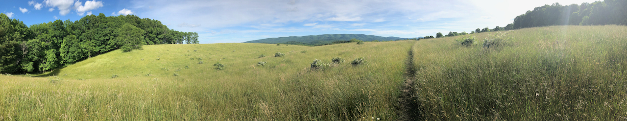
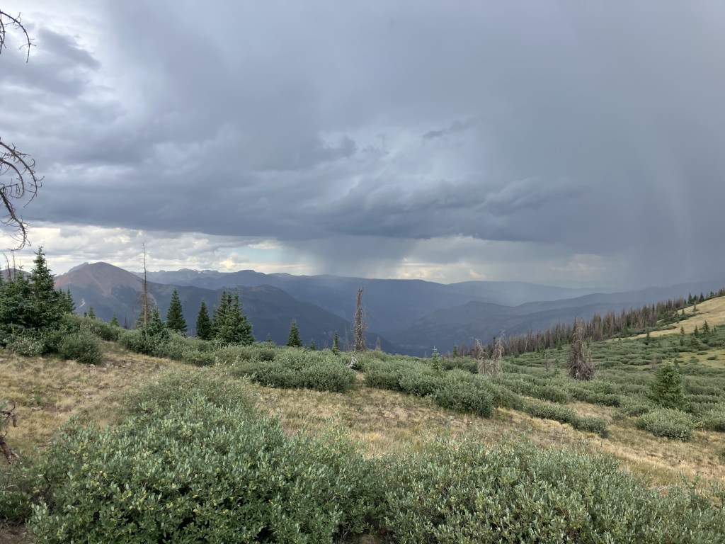
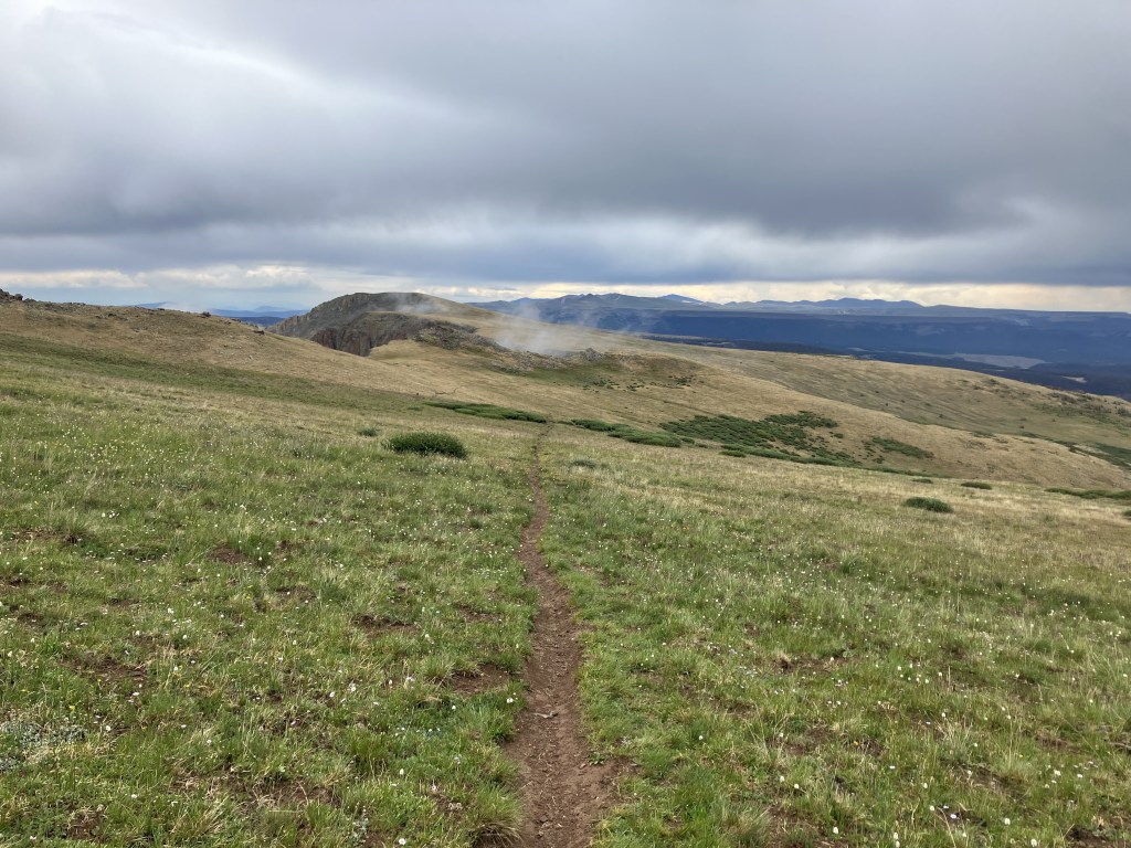
The walk this morning began with a gentle ascent through open… I dunno what exactly. You could call it pasture but it’s so high that that seems a poor descriptor. Alpine prairie I guess? It’s exposed with grand views of the snow-covered mountain ranges ahead, each of which seems to stretch across the entire horizon. If this were the AT, you’d know you were destined to ascend the tallest ridge and remain there. But this is the CT—it’ll seek reasonable passes and stick to valleys with views as much as practical. If the CT were built in the style of the AT, it’d be 3000 miles long, average 13500 feet elevation, and everyone who tried to thru-hike it would be dead from exhaustion and pika predation.
Like clockwork, just after 10, the clouds came, then storms. But first some cell service! A young woman walked over a rise, coming in my direction, and I saw her talking on her phone. Talking on her phone?! There was a cell tower a few mountains ahead, she told me, smiling at my tired joy, and it’d leave us in range for hours.
Fools gold! I had four bars of 3G but it was “extended network” and although it let me get a call out to my family, I couldn’t get even a trickle of data or any texts. I changed some settings on my phone (here’s a fun stat—I’ve used nearly a terabyte of mobile data over the last few months—yeesh!). Maybe I have been throttled. Maybe I deserve to be throttled! Eventually I got a trickle. Managed to get one good podcast episode (Andrew Weissman and Mary McCord’s Prosecuting Donald Trump), then most of another. And texts. I felt reconnected at last! I really just wanted to hear about the latest indictments against one of our former presidents, won’t say which. As I got nearer the cell tower, the weather looked more and more threatening.
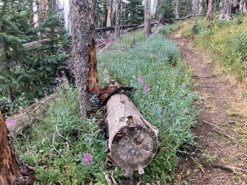
I dodged storms for a while. There always seemed to be shrubbery and a few trees around for shelter should I need it. Eventually, about nine miles into the day, the rain got steady enough that I needed to stop. Or maybe it was really the seeping, wet cold that pushed me to my “tarp limit” (the point beyond which I take shelter under my tarp, which also functions as the rainfly for my tent). There were a few other tents around at the edge of a mostly dead forest. I filled up at the last water source for ten miles.
I heard loud, close thunder in my minimalist shelter (I didn’t set up the inner tent). Rains came and went while I wrote, rested, and snacked. Here’s another fun fact about my journey: I’ve now lost a toenail, regrown it entirely, and lost it all over again while breaking in these new boots. Seems like a sufficient (but not necessary) threshold for feeling like a “real” thru hiker. Jeff Foxworthy: “if yoove evar lawst a toenayull on a backpackin triyup, and then lost that saym toenail aginn on the same triyup, you jest maht be a thru-hiker.”
I took down my shelter set off again around 3:30. It looked like the clouds were lightening around the edges, perhaps even with a chance for more sun. Baseless optimism! Foolishness!
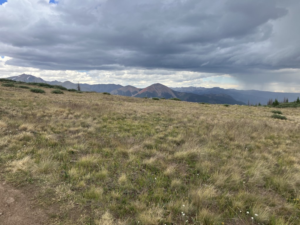
The rain just fucking lingered. It was a mistake to leave those last trees, those last campsites among the willow. Once the trail was above treeline it stayed there. On the whole I got lucky. If I had been a few hours ahead, I would have been in much worse weather. I only dealt with winds and cold and moderate rain. That was quite enough.
I had miles and miles of wind blasted rock and grass to traverse. Maybe it was the (unavoidably) dark tone of the book I was listening to (Confidence Man by Maggie Haberman). Maybe it was just being able to see for miles and miles in every direction and know that no one else had been dumb enough to walk up here at this time of day.
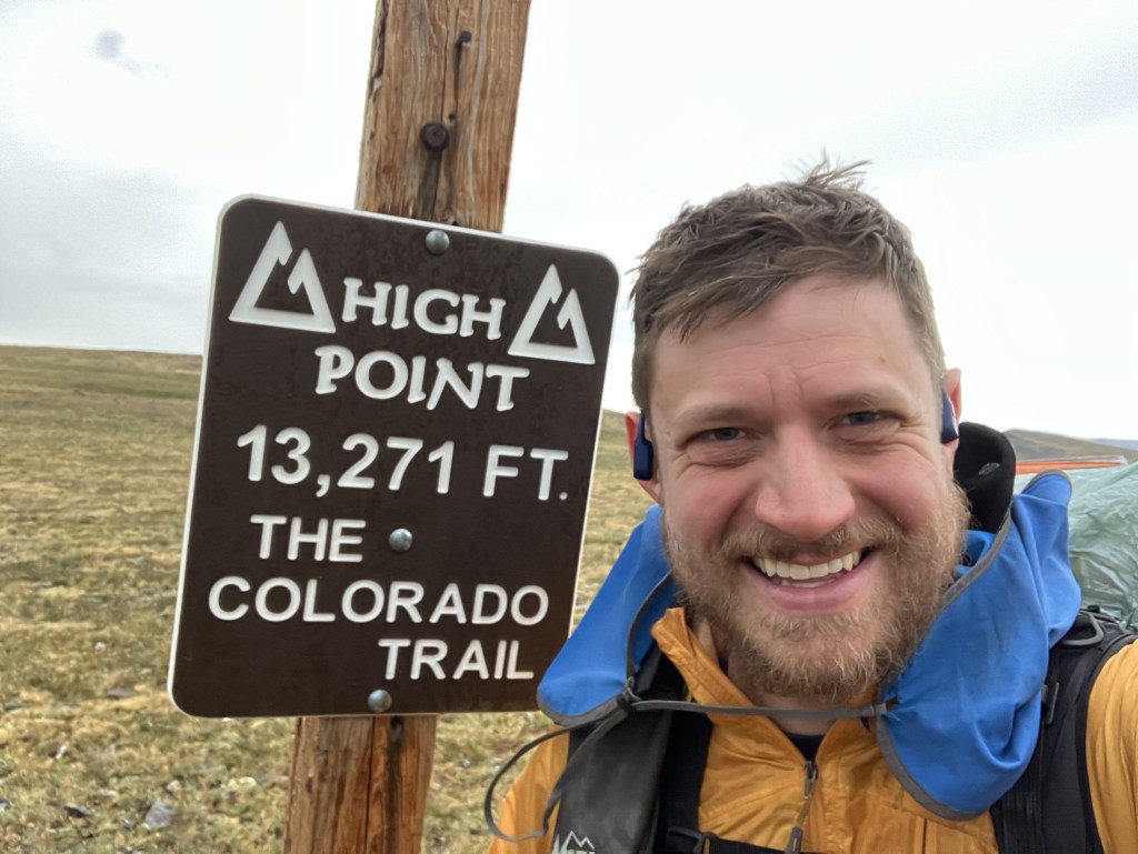
How do you end up in situations like this? Oh, any old way. Mileage hunger. Unwarranted optimism about weather clearing. Ignorance. Poor cognitive function caused by exhaustion. Setting the elevation map on your navigation app too low. As an example of this last, consider this screenshot from my navigation app:
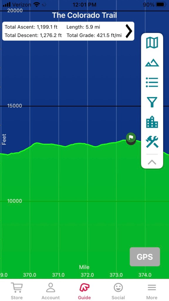
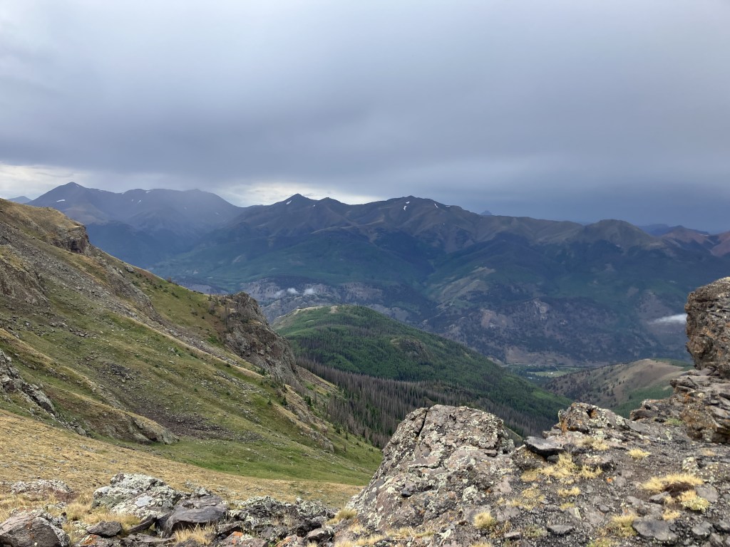
Those three little lumps are huge ridges, hogback shaped. They swoop into the sky, and they take the path with them. The little green flag you see on the right side of the image is the high point of the section and the entire trail, 13,271 ft. Looks like nothing; still took hours. I’m alone on a desolate planet, beamed down on an away team of one.
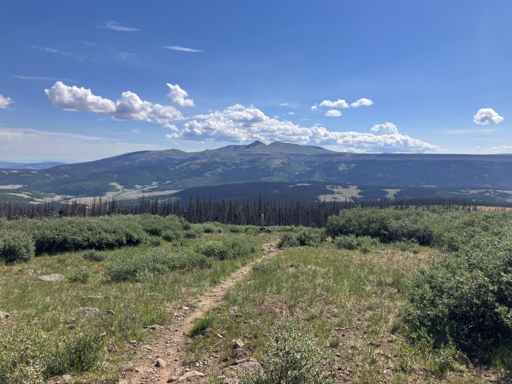
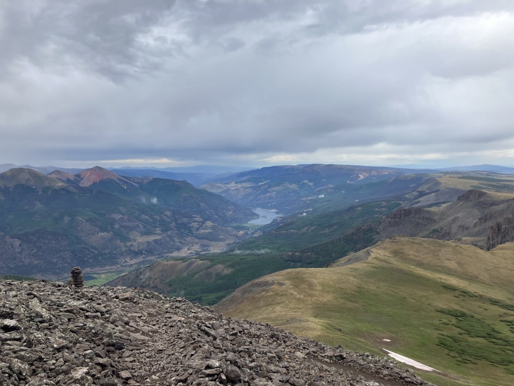
After I crested the high point, I began a steep descent via double track mining roads. Old shacks and dynamite storage sheds dot the landscape. I saw three tents far down in a valley, next to a pond, on top of old tailings. It looked as if they had had to descend because of severe weather. I could see evidence of hail on my way down from the high point, and anyway it’s unlikely hikers would have chosen to lose so much elevation, down such a steep hill, for any other reason.

It was a hard hike. The last ten miles were miserable. It was storm after storm. It kept looking like conditions would improve, but they never did.
I hiked until 8:30 to get *almost* below tree line to camp. I had to settle for a lumpy spot with thistle. I had all manner of trouble getting the tent together in the rain and waning light. I didn’t realize there was another group near me among the bushes, or I wouldn’t have cursed so loudly while setting up my tent in light rain. I am not getting out of this tent tomorrow until the sun is shining directly onto it.
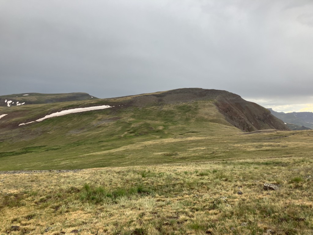
The next section is entirely above tree line—heavens, what to do? From here it is 22 miles until the trail again sees fit to descend among the trees. I do not have that distance in me after a 19-mile day. Nor do I have it in me to guarantee good weather by getting up at 3AM after such a long miserable day.
Those last five miles above treeline will always be with me. I will think of those wind blasted, wet, lonely miles whenever I need to imagine myself alone and far from safety.
I got through it, though I was really unnerved by the rain and encroaching dark. I felt scared. There were many tents around at the end, which was some comfort—this area is the lowest the trail goes for a while. Some folks went far down into the valley for spots. I would guess they are less smooth up close than they appear from up here.

Leave a comment