6/10/2023 Saturday
Neil and I grabbed breakfast at a cash only place across the street, Goodies. Great breakfast sandwiches, small town diner feel. We walked back to Kinda Outdoorsy and packed up. My food bag is too heavy.
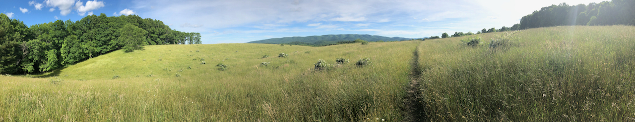
The trail takes two miles to walk through neighborhoods and city streets. The sun is hot and there’s little shade. The old houses of Duncannon sit close to the road. It could be a Pittsburgh neighborhood.
We reached the enormous bridges over the Juniata and Susquehanna rivers. Neil wanted to stop on the bridge for selfies but I found the narrow concrete channel designated for pedestrians too precarious. We crossed some railroad tracks and then began a steep, rocky ascent into the forest. It took us a few hours to reach Clarks Ferry shelter, even though it was only 3-4 miles. The rugged terrain slowed our pace to a crawl.
We talked about any old thing. Life mostly. Who among our old friends is doing what. Our respective families. Hopes, fears, dreams.
Early in the climb a day hiker let me know that there’s a blowdown ahead. I’m not sure what to do with this information. When we reached the blowdown I said, “I’m so glad I was warned.” I had just been complaining to Neil about this exact trail pet peeve. “There’s a snake five miles up!” What in the hell can you do with that? Be vigilant and anxious for five miles?
There was one other guy at Clarks Ferry shelter area. He passed on a warning he’d been given about hornets near the water source. He hadn’t gone down yet himself. We walked down anyway, because it’s that or go without water. No hornets we could see. Good spring though.
The afternoon miles brought rock fields aplenty! Minor scrambling. Also the most poison ivy I’ve ever seen on trail. Miles and miles and miles of the stuff. Very unwelcoming! I worried our trekking poles would get covered in the oil. We did our best.
Neil went out ahead and turned down some trail magic at a parking lot. I stopped and they gave me a Gatorade and a banana. The woman, who looked as if she’d had a serious medical operation recently, told me it was my lucky day. She had a big thing of banana bread. She turned smiling opening the Tupperware container. I had to turn her down! My food bag is stuffed and I need to eat the food I brought so I won’t have to carry it. She looked crushed! Oof, that is gonna leave a karmic mark.
When we arrived at the next shelter (Peters Mountain) there were tons of tents around in marginal spots but no one staying in the monster double-decker shelter. It’s weird how few people have been sleeping in the shelters lately. Everybody wants to tent. We tented.
The trail to the water source at this ridgeline shelter entails 300 feet of elevation loss in only .2 miles. That’s rough. The rock stairs seemed to go on and on, which is tougher when you know you’ll have to climb right back up. It’s in the top three most heinous side-trail water fetches I’ve undertaken. The water below Abingdon Gap Shelter is nearly as bad. Also there’s an obscure water trail halfway up Roan High Knob that is a similar level of nutty. Still, the water source was neat as hell. It’s a tiny spring at the foot of an immensely tall steep stone staircase. One could believe the oddly square stones to be remnants of an ancient temple. Locating that spring, and building a trail down to it, is a Herculean achievement. Bravo to those responsible.
I hauled four liters up the hill. I arrived back at the shelter drenched in sweat. A bunch of the water sources ahead are dry according to the app. About 6.5 miles to the next good water source tomorrow. That can be a long walk in hot weather (high of 86) and rough terrain. We’ve got some other problems on the horizon: Monday’s forecast predicts severe storms. That could change but tomorrow we are going to have to develop some contingency plans. And my headlamp won’t take a recharge.

Leave a reply to Cynthia Cloud Cancel reply